The Salcombe-Kingsbridge Estuary is located in Southern England, in Devon. At the origin of this estuary, an unglaciated river valley, called a ria, gradually flooded by several small rivers that continue to feed it. The estuary then connects to the Channel. Several pollutants affect the quality of the water. With nutrients transported by rivers to the estuary, it experiences algal blooms that impact local activities and economies.
The catchment is typical of the area, small and short, as there is no main river feeding in but multiple small rivers. Four main types of activities are impacted and impact the quality of water: boating, tourism, agriculture and sanitation.

Tourism and boating are highly developed in the estuary, but also agriculture, which is predominant practice that covers 88% of the territory. Local businesses vary in size from the smallest to businesses of 40 to 50 individuals.
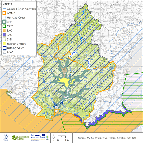
Several acts frame the activities of the various watershed stakeholders, the use of water, land and biodiversity. They result in several devices that specifically regulate activities in the Estuary area and in particular there are restrictions on the activities of farmers: these include, a Nitrate Vulnerable Zone, Bathing Waters, a Site of Special Scientific Interest and Shellfish waters "Salcombe".
Phosphate and nitrogen, of various origins, are brought into the receptor, the Salcombe-Kingsbridge estuary, which exhibits dense algal blooms. When they get caught in boat propellers they disrupt boating and by reducing the aesthetic quality and attractiveness of landscapes they reduce tourism. They also lead to blooms of cyanobacteria, possibly toxic for the different activities. Shellfish farmers must also purge their shells.
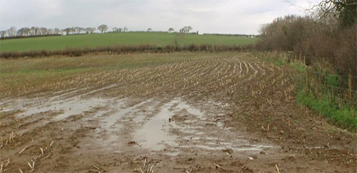
The multiple rivers feeding the estuary are all means of moving multiple pollutants from different areas. Agriculture is a major contributor to water pollution, but septic tanks also play a role in the pollution.
Costs related to water pollution are borne by all the impacted parties: a decrease in tourist attendance, increase in boat maintenance costs, reinforcement of standards on water companies and increase of their treatment costs, and increased costs to farmers through the loss of nutrients applied to soils. One of the challenges of the CPES project is to understand the cost-benefit trade-off between the current situation and the improvement brought by changes in practices.
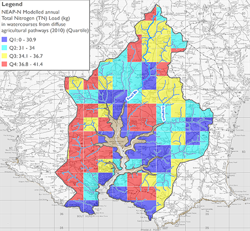
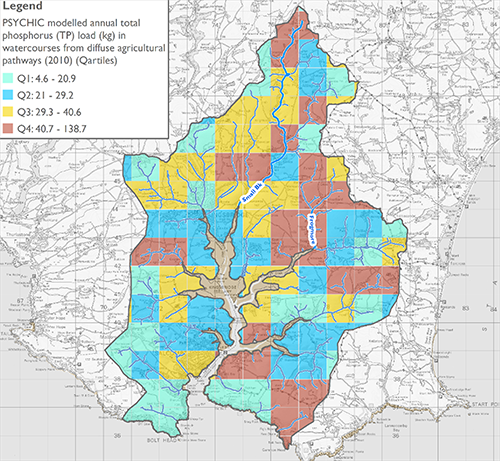
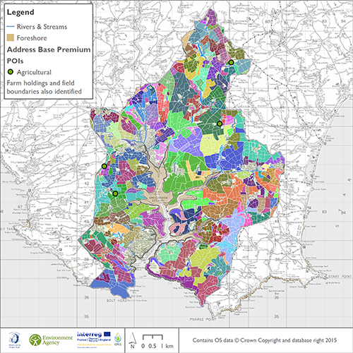
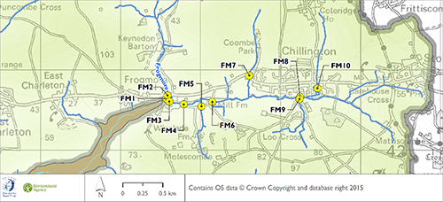
To understand the risk factors specific to the catchment, the case-study pilots first study the available data on geology and soils, the density of the population and the coverage of the territory. To refine the modalities of loss of nutrients, the PSYCHIC and NEAP-N models make it possible to model the phosphate and nitrate loads, respectively, in the watershed. Data from the Environment Agency analysed by individual points make it possible to identify the most polluting places, to better identify causes and target actions. It is through this deep understanding of the environment and the functioning of the ecosystem that the construction of a payment for environmental services can be the fairest and the most profitable.
